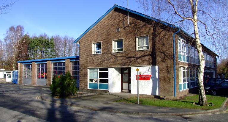
A photo of Kendal Fire Station
Our stations

Kendal Fire Station

Kendal Fire Station
Busher Walk
Kendal
LA9 4RH
United Kingdom

Tel
0300 303 8623
Station type
Wholetime and On-call

Kendal fire station is staffed by Regular and On-call Firefighters and houses 2 fire engines and a Prime Mover which is used to transport the county's 2 High Volume Pumps (HVP).

The HVPs, in addition to giving Cumbria the capability of tackling serious flooding incidents, have been used very successfully, on a national basis, outside the county too. Risks in the area include responding to road traffic collisions due to the adjacent M6 motorway and the nearby 'A' roads. The River Kent originates in hills surrounding Kentmere, and flows for around 20 miles into the north of Morecambe Bay. The stations firefighters receive specialist training to deal with water incidents.

Drill night
Thursday 1900hrs
Area
Westmorland & Furness

About Kendal Fire Station

Station profile

Local stations

  • Staveley - 4 miles
  • Milnthorpe - 8 miles
  • Windermere - 8 miles

36,00 population

Crewing type

Wholetime and On-call

Fleet

  • 2 fire engines
  • 1 high volume
  • 1 boat

History

Kendal is situated in the south east of Cumbria and is mainly an industrial town formed by many small industries with a population of around 33,000. The towns' ideal location means that it attracts a large transient population of holiday makers on their way to the Lakes increasing the sleeping risk particularly during the holiday seasons. In the recent past, the towns' success was mainly due to businesses like shoe manufacturing and the insurance industry, now however, the town continues to be successful by way of a varied industrial work-base. 

Demographic and social profile of station area

Further information for this fire station is available on a number of themes at the Cumbria Intelligence Observatory, including:

  • Population 

  • Crime and Community

  • Health and Social Care

  • Housing

  • Economy and Employment

  • Environment

  • Children and Young People

Please visit www.cumbriaobservatory.org.uk and choose a fire station area for your particular theme of interest.

Risk information

The area contains:

• 5 Grade 1 and 19 Grade II listed Buildings

• 7 Sites of Specific Scientific Interest

• Site Specific Risks within the station area, Watchgate Water Treatment Works, Westmorland General Hospital, Furmanite International Ltd, Farleys Health Products, James Cropper, Westmorland Shopping Centre, National Grid Sub Station

• Kendal Station area has significant flood risks. The Flood Risk area covers approximately 9.4 Km2 from James Cropper paper mill in Burneside village to Helsington Mills at the southern extremity of Kendal. The Kent rises in the hills surrounding Kentmere and flows only a short distance of 32Km before entering the sea at the Northern End of Morecambe Bay. The Kent has three main tributaries joining upstream of the town, the Mint, Sprint and Gowan. The flood catchment is predominantly rural apart from the urban area of Kendal whose early industry developed alongside the banks of the Kent. There are almost 1500 properties at risk.